 Andri Hendrizal
Mangrove Distribution Map
Existing mangrove area and potential mangrove habitat area by province, 2024, based on Indonesia's National Mangrove Map. Click a province to see its figures; this page currently maps province-level totals, not individual mangrove patches — see the note below for why.
Existing Mangrove: current mangrove cover. Potential Habitat: coastal land not currently covered by mangrove but suitable for mangrove rehabilitation (e.g. former aquaculture ponds or degraded mangrove land).
Source: Decree of the Indonesian Minister of Forestry No. 594/2025 on the 2024 National Mangrove Map, Annex II (province-level totals only — the source document does not include per-polygon mangrove geometry). Province boundaries: Indonesia GeoJSON & TopoJSON Maps (38 Provinces) by denyherianto, CC BY 4.0.
Static Reference Maps
Print-ready versions of the map above, with scale bar, north arrow, coordinate grid, and a Southeast Asia locator inset — for citation, reports, or presentations.
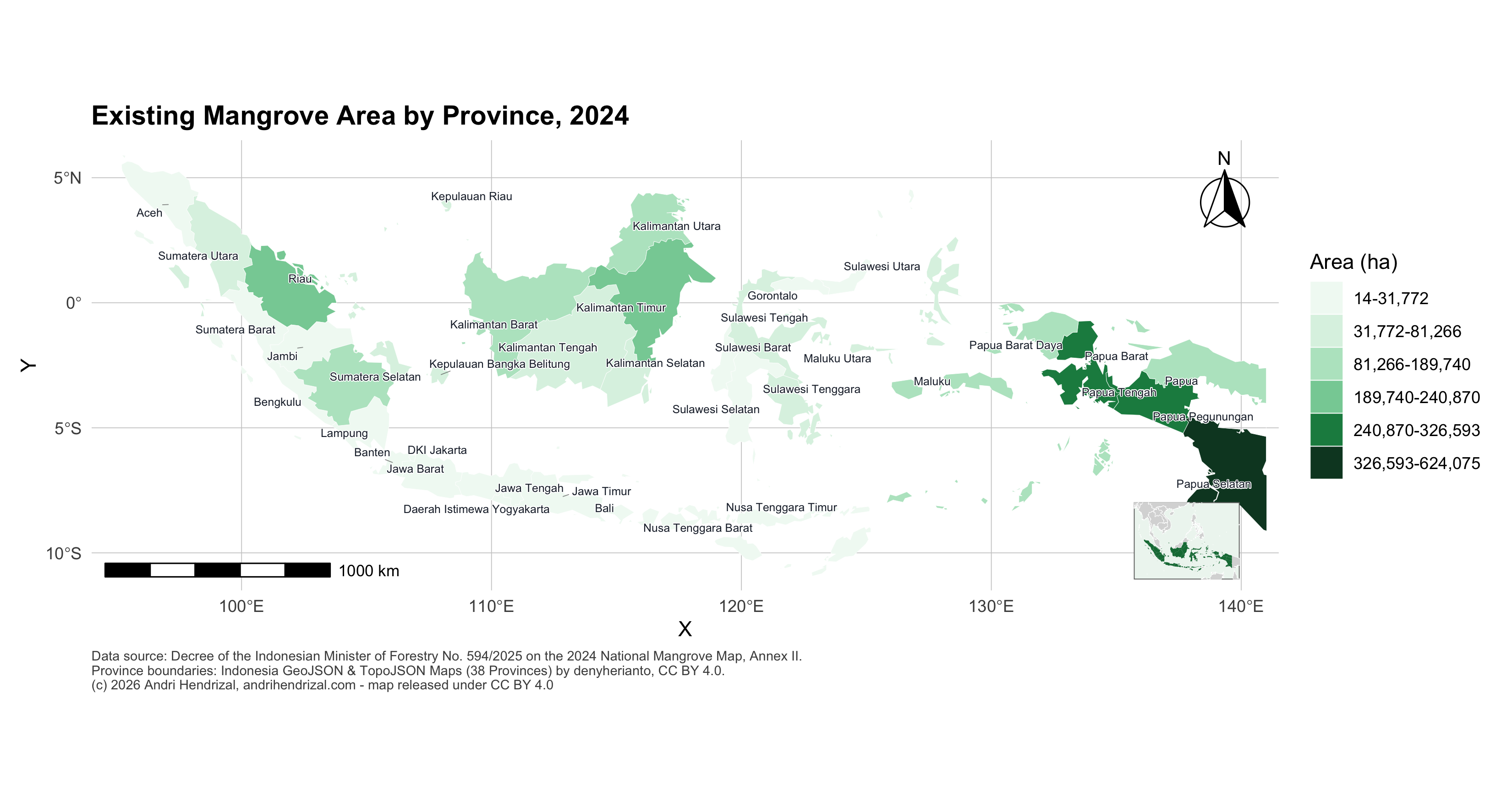 Existing MangroveDownload PNG (300 dpi)Download PDF (vector)
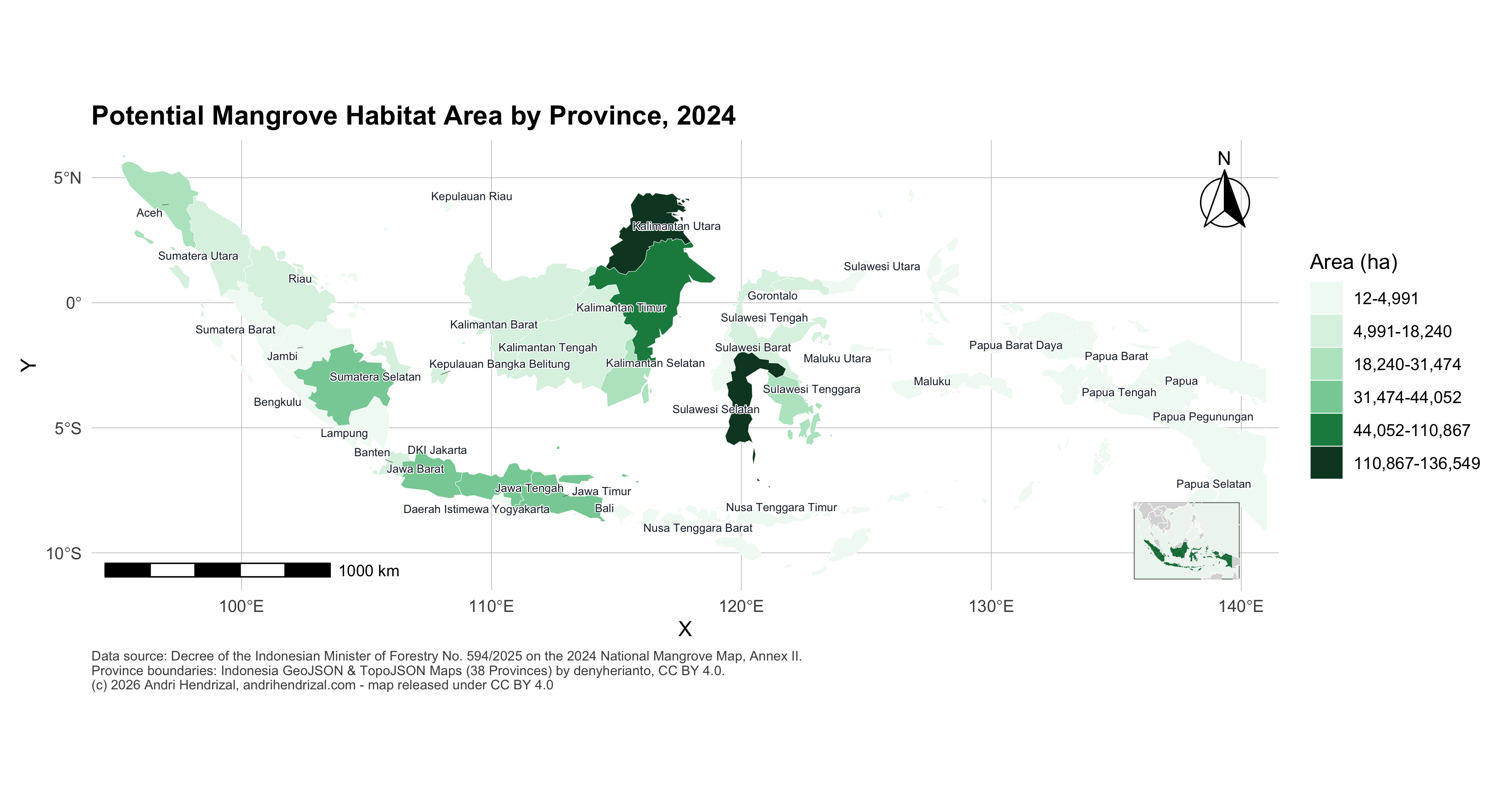 Potential HabitatDownload PNG (300 dpi)Download PDF (vector)
How to Cite
This map is an original work by Andri Hendrizal, compiled from public data, and is released under a Creative Commons Attribution 4.0 (CC BY 4.0) license — you are free to reuse and adapt it, including commercially, as long as you credit the source below.
Hendrizal, A. (2026). Indonesia Mangrove Distribution Map by Province, 2024. andrihendrizal.com. Data: Indonesian Ministry of Forestry, Decree No. 594/2025. https://andrihendrizal.com/en/mangrove-map/